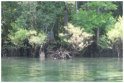
A variety of parks await the explorer in Walton County
Anyone living in Walton County, or the Florida Panhandle for that matter, share something in common. We all live in a place that hosts the most beautiful beaches to be found anywhere. The shimmering Gulf of Mexico, the soft white sand, the rolling dunes… this area is a location that is hard to beat.
With many beach accesses and several state parks in the area, the beaches can be enjoyed easily.
Walton County offers much more to experience, however, with an abundance of local parks north of the beach offering a touch of nature and beauty all their own.
From the cool, clear water of Morrison Springs in the northeast end of the county, to Lost Lake near Bruce, there is a wide variety of flora and fauna can be experienced in the many parks Walton County has to offer.
Many of the parks have playgrounds and sports facilities, along with walking trails, swimming holes and boat ramps.
So, pack a lunch, or put on your hiking boots, here is a list of a great 28 that are right here in Walton County:
1. Lake Jackson
From U.S. Highway 90 in DeFuniak Springs go north on U.S. Highway 331 for 18 miles. Turn left onto Lake Road and follow until park comes into view. This park has no facilities, only a boat ramp. Click here for map
• Boat ramp
2. Lakewood Park – Florida’s Highest Point
Take U.S. Highway 331 north through DeFuniak Springs. Once past DeFuniak, go 18 miles and turn right on County Road 285. Park will be on left side of road.• Picnic area, restrooms, scenic view Click here for map
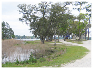 3. Cat Island
Take U.S. Highway 331 north through DeFuniak Springs to U.S. Highway 90 and turn right. Turn left on N. 9th Street (SR 83) and travel 3.3 miles. Turn left onto Cat Island Road. Follow this road to its end, approximately 1 mile.
• Picnic area, restrooms, boat ramp
Click here for map
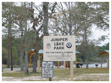
4. Juniper Lake
Take U.S. Highway 331 north through DeFuniak Springs to U.S. Highway 90 and turn right. Turn left on N. 9th Street (SR 83) and travel 2.6 miles. Turn left onto Juniper Lake Road, traveling for approximately 0.8 miles. The county lands sit along both sides of the earthen dam. • Picnic area, restrooms, boat ramp Click here for map
 5. Wee Care Playground
Take U.S. Highway 331 north through DeFuniak Springs to U.S. Highway 90 and turn right. Turn left on N. 9th Street (SR 83) and travel 1.5 miles. Turn left onto Walton Road and proceed for approximately 0.4 miles. The children’s park is located on the right, across from Walton High School. • Playground, restrooms, picnic area Click here for map
6. Recreation Complex– DeFuniak Springs
Located at 965 Gene Hurley Road, west of DeFuniak Springs, off of U.S. Highway 90, just west of U.S. Hwy. 331. Turn south on Gene Hurley Road, around the landing pad of airport, park is on the left.
• Playground, picnic area, restrooms, ball fields, skating and rollerblading ramps, nature trail Click here for map
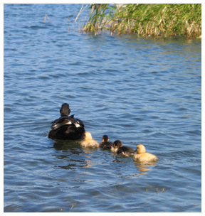
7. Chipley Park (Lake DeFuniak)
Located in downtown DeFuniak Springs on Circle Drive. • Playground, boat ramp Click here for map
8. Douglass Crossroad Ball Park
Head east on U.S. Highway 90 in DeFuniak Springs for 4.1 miles. Turn right on CR183S for 2.8 miles. Immediately after crossing over I-10, turn left on Douglass Crossroad and go approximately 1.5 miles. The park is on the right.
• Playground, restrooms, ball fields Click here for map
9. Berrian Lake
From the Walton County Courthouse, Berrian Lake can be accessed most easily by following U.S. Highway 90 into Holmes County and reentering Walton County from CR 181A. Head east on U.S. 90 for 10.5 miles. Turn right onto CR 181A and go for 1.1 miles until reaching Old Mt. Zion Road. Turn left and follow for 2.1 miles until road forks. Follow the right fork for 1.9 miles to CR 181. Bear left and go for 0.6 miles, then turn onto Berrian Lake Road. Continue on this road, following the signs to the landing.
• Boat ramp Click here for map
10. Cedar Log
Take U.S. Highway 331 north to State Road 20 in Freeport. Turn right and go to State Road 81. Turn left and go right on CR 181 for 2.1 miles then right on Cedar Log Road (dirt) for 1.3 miles to ramp.
• Boat ramp
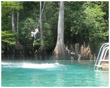
11. Morrison Springs
Take U.S. Highway 331 north to State Road 20 in Freeport. Turn right and go to State Road 81. Turn left and go past Red Bay to County Road 181C. Turn right and continue for 1.6 miles. Then, turn right onto Morrison Springs Road and follow to its end.
• Picnic area, restrooms, swimming, diving, boat ramp click here for map
Click here for story and video on Morrison Springs
12. Comander’s Landing
Take U.S. Highway 331 north to State Road 20 in Freeport. Turn right and go to State Road 81. Turn left and go past Red Bay to River Road, proceed to the end of the road.
• Picnic area, boat ramp Click here for map
13. Bruce Creek Park
Take U.S. Highway 331 north to State Road 20 in Freeport. Turn right and go to State Road 81. Turn left and go past Red Bay to Camp House Landing/Louis Miller Road and turn right.
• Boat ramp Click here for map
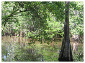
14. Dead River Park
Take U.S. Highway 331 north to State Road 20 in Freeport. Turn right and go to State Road 81 follow Dead River Road. Turn left beside the Dead River Cemetery and follow the clay road to the road’s end.
• Picnic area, boat ramp, portable toilet
15. Seven Runs Park
Take U.S. Highway 331 north to State Road 20 in Freeport. Turn right and go to State Road 81. The park is on the left (west) side of the road at the foot of the Seven Runs Creek Bridge. The newly opened Florida Trail at Nokuse is just south of Seven Runs Park.
• Picnic area, Boat ramp, Portable toilet Click here for map
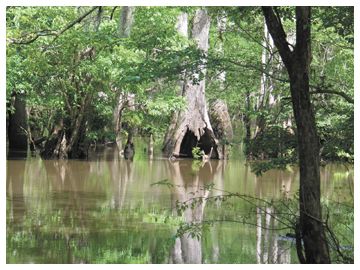
16. Tilley Landing/Lost Lake
Take U.S. Highway 331 north to State Road 20 in Freeport. Turn right and go to State Road 81. Turn left and take State Road 81 until you see the sign on right.
• Primitive camping, portable toilet, boat ramp, picnic area Click here for map
For more information on Lost Lake Click here for story on Lost Lake at Tilley Landing

17. H. A. Laird Park
Located on SR 20 West about 1.5 miles west of the intersection of U.S. Highway 331 and State Road 20 West.
• Playground, picnic pavilions, restrooms, short trail
Click here for map
18. Alaqua Creek Park
From Freeport: Head west on SR 20 for approximately 2 miles. Park is on the north side of State Road 20.
• Picnic area, boat ramp, , restroom, swimming, portable toilet Click here for map
19. Alaqua Park
From Freeport, head west on SR 20 for approximately 3.6 miles. Turn left onto Portland Park Road. Follow this clay road to its end.
• Picnic area, boat ramp Click here for map
20. Choctaw Beach Park
More than a boat ramp, the Choctaw Beach Park offers spectacular sunsets and many public amenities on the north side of the Choctawhatchee Bay. From Freeport, head west on SR 20 for approximately 12 miles. The park is on the left, fronting the bay. • Picnic area, restrooms, pavilion, playground Click here for map
21. Freeport pool
Managed by the YMCA
Located behind Freeport City Hall on SR 20 in Freeport.
• Open Mid May – Labor Day, $1 for 3 hours of swim time. For more information call (850) 835-1223 Click here for map
22. Casey Kids Park
Casey Kid’s Park is located next to city hall on State Road 20 in Freeport
• Playground, picnic area Click here for map
23. Wheeler Point Park
This easy-to-find park sits at the north foot of the Clyde B. Wells Bridge on U.S. Highway 331.
• Picnic area, restrooms, boat ramp
Click here for map
25. Cessna Landing
Take County Road 393 north from U.S. Highway 98 approximately 3 miles. Cessna Landing is on the left.
• Picnic areas, restrooms, playground with ball courts, boat ramp
Click here for map
26. Helen McCall Park
Helen McCall Park is off U.S. Highway 98 in Santa Rosa Beach west of County Road 393. Turn south onto Moll Drive and follow to the park.
• Playground, ball fields, restrooms Click here for map
27. Legion Park
Legion Park is located in Miramar Beach approximately 1 mile west of Sandestin off U.S. Highway 98. Going west turn left on Ponce deLeon Drive. Park is located at the end of the street.
• Playground, picnic area, restrooms, basketball court, shuffleboard court, boat ramp
Click here for map
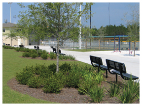 28. Freeport Regional Sports Complex
Freeport Regional Sports Complex is located off State Road 20 in Freeport, on CR 83A.
Baseball/softball fields, football/soccer fields, tennis courts, sand volleyball court, basketball courts, shuffleboard courts, playground, barbecue/picnic areas, playground, restroom, walking trail. Click here for map
29. The Point
Know by the locals as The Point, the park now boasts more than 20 parking spaces and several boat slips. In addition, there are restroom facilities and walkways that wrap around the waterfront.
Directions:
Take State Road 20 and turn south on CR83A across from City Hall. Turn left on Four Mile Road (Shipyard Road). Follow the road past Freeport Shipyard. The park is at the end on “The Point.” Click here for map
30. Fishing Pier on Lake Powell
The fishing pier is located at the eastern end of South Walton County of U.S. Hwy. 98 on Lake Shore Drive off of Orange Street, north of Inlet Beach. It is is approximately 50 feet in length with a 10×15 ft. deck at the end with a bench overlooking the lake. Click here for map
