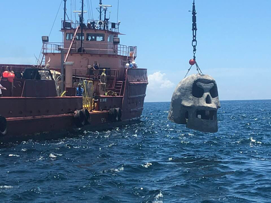
For divers, snorkelers, and anglers seeking to explore artificial reefs off South Walton’s coastline, a welcomed addition to recreation is now established. South Walton Artificial Reed Association (SWARA) has deployed 15 artificial reef structures off the shorelines of the Gulf of Mexico in Walton County. It total, there are more than 700 reef structures composing four snorkeling reefs, 11 fishing/diving reefs, and one Underwater Museum of Art. The museum consists of seven sculptures 60 ft. below the surface, .7 miles offshore.
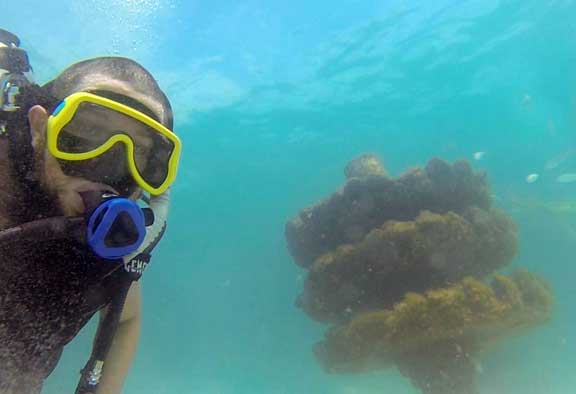
Each reef structure is constructed with limestone rocks embedded in 5 ft. diameter concrete plates; boasts a 10″ diameter fiberglass piling sunk deep in the seabed and springs up to a maximum profile height of no more than 10 feet at the deepest water depth. This results in a minimum authorized depth clearance of -6 feet at mean low water (MLW). The design is geared for snorkelers wanting to enjoy marine life close to shore.
Interested in finding a guide or area dive shop? Click here.

Snorkeling Reefs
SWARA snorkel reefs are located approximately 250–300 yds from shore. It is strongly recommended snorkelers use a kayak, paddleboard, or other flotation device when visiting the snorkel reefs. Sea conditions can and do change quickly and often.
 Florida State Law requires that all divers prominently display a diver-down flag or buoys in areas where diving occurs.
DOLPHIN REEF
Miramar Beach
N 30°22.5230′ W 86°23.3245′
Depth: 12-20′
Distance from Shore: 685′
Bearing: 188°
Google Map
SEAHORSE REEF
Topsail Hill Preserve State Park
N 30°21.3501′ W 86°16.6638′
Depth: 13-18′
Distance from Shore: 715′
Bearing: 195°
Google Map
TURTLE REEF
Grayton Beach State Park
N30° 19.338′ W86° 9.491′
Depth: 12-19′
Distance from Shore: 783′
Bearing: 200°
Google Map
GROUPER REEF
Inlet Beach
N30° 16.202′ W86° 0.352′
Depth: 12-21′
Distance from Shore: 970′
Bearing: 204°
Google Map
Fishing & Diving Reefs
Most SWARA fish/dive reefs (excluding Fish Haven #1, #2, and Frangista Reef) are located within one nautical mile of shore. Fish Haven #1, #2, and Frangista Reef are between two and four miles offshore. A GPS device is necessary to accurately locate these sites. Visitors planning to dive the reefs you should be trained and certified in SCUBA diving. Remember, don’t dive beyond your limits. Unless you’re spearfishing—take only pictures and leave only bubbles. Please be respectful of our marine environment and make safety your highest priority. Weather and sea conditions can and do change quickly and often.
MIRAMAR BEACH
Miramar Beach
N30° 21.887′ W86° 23.370′
Depth: 62′
Google Map
MIRAMAR-FRANGISTA
Miramar Beach
N30° 19.792′ W86° 22.857′
Depth: 68-75′
Google Map
FISH HAVEN #2
Santa Rosa Beach
N30° 16.120′ W86° 13.880′
Depth: 89′
Google Map
BLUE MOUNTAIN
Santa Rosa Beach
N30° 19.381′ W86° 12.033′
Depth: 55′
Google Map
TOPSAIL BLUFF
Santa Rosa Beach
N30° 21.388′ W86° 19.338′
Depth: 61′
Google Map
FISH HAVEN #1
Santa Rosa Beach
30° 19.315′ W86° 17.895′
Depth: 75′
Google Map

UNDERWATER MUSEUM OF ART
Santa Rosa Beach
N30° 18.671′ W86° 9.647′
Depth: 59′
Google Map
SANTA CLARA
Santa Rosa Beach
N30° 18.059′ W86° 7.338′
Depth: 55′
Google Map
FORT PANIC
Santa Rosa Beach
N30° 20.360′ W86° 15.343′
Depth: 61′
Google Map
SHUNK GULLEY
Santa Rosa Beach
N30° 19.967′ W86° 13.874′
Depth: 59′
Google Map
DEER LAKE
Panama City Beach
N30° 17.388′ W86° 4.835′
Depth: 57′
Google Map
INLET BEACH
Rosemary Beach
N30° 15.688′ W86° 0.871′
Depth: 58′
Google Map
To learn more about SWARA, click here.
About artificial reefs:
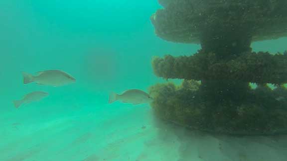
Within hours of deploying a concrete reef, small fish move into their new home. This initiates a parade of marine life over several months. The hard structure of an artificial reef is slowly colonized by soft corals, sponges, plants, and barnacles. The smaller fish will soon have new neighbors, as snapper and grouper take residence. Nearby sand sediments come to life with sea stars, sand dollars, and other invertebrate species. Click here to learn more about the benefits of artificial reefs.
One month after deployment:

